Your comments


Good day!
Sir/madam, if you're referring to the Lot Plotter of the Geoportal, the BLLM is already embedded in the app.
The data is from the Land Management Bureau but as of now, not all municipality has a complete tie point data.
Thank you.
Good day, Mr. Ramos!
Sir, to download a data from the Geoportal website, a layer must not have a download restriction.
To check, kindly follow the link below:
https://www.geoportal.gov.ph/resources/PGPDataInventorywithSW&Trng.pdf
You may also opt to consume the data using Web Map Service by following the steps provided in the website.
Access the Menu option in the upper left corner of the interface then click on the Resources Menu.
Should you have other questions or inquiry regarding the site, you may email us at css.gismb@namria.gov.ph.
Thank you.
Good day, Mr. Iguin!
Sir, the Climate Type data from DOST-PAGASA is marked for conditional downloading and cannot be downloaded directly in the Geoportal Philippines website. This means that you should request directly to the owner to acquire the data. Kindly check the metadata of the layer to more about the layer and its source.
For info regarding the status of data restriction for downloading, please visit the link below:
https://geoportal.gov.ph/resources/PGPDataInventorywithSW&Trng.pdf
Thank you.
Good day!
Sir, the layers presented in this website is based on the data shared by the stakeholders.
It is on their end to decide what data they are going to share.
You may also email us at geoportal@namria.gov.ph or at css.gismb@namria.gov.ph so that you can contact us directly.
Thank you.
Good day!
Sir, paki-expound pa ng inquiry nyo para matulungan po namin kayo.
You may also email us at css.gismb@namria.gov.ph so that we can contact you directly.
Thank you.

Good day! The Geoportal Philippines website is working just fine. Please try again. Thank you.
Good day!
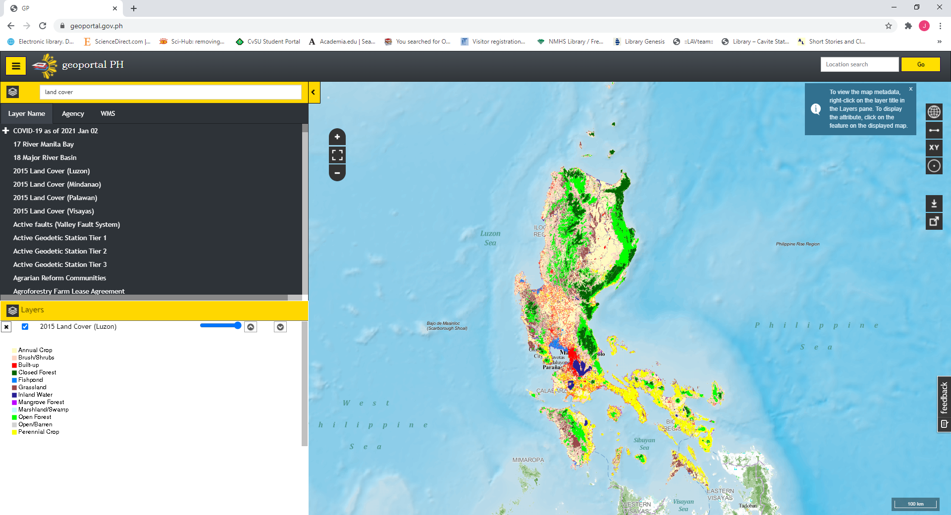
Sir, you can find the legend of the displayed map at the bottom left side of your internet browser.
Thank you.
Good day!
Sir, the URL to connect is:
http://geoserver.namria.gov.ph/geoserver/ows?service=wms&version=1.1.1&request=GetCapabilities
Before loading any link layer, please load any shapefile data, eg. boundaries to your GIS software.
Thank you
Good day! Sir/madam, each control points, when you click on one, has a station name, corresponding coordinates and description. May we know your exact concern? Is there a control point that has no description? Kindly email us at css.gismb@namria.gov.ph so that we can answer your concern directly. Thank you,
Customer support service by UserEcho


Good day! Sir, for data with conditional downloading status, you may need to request it directly to the data owner. thank you.